 Rare Maps
  Rare Atlases
  Rare Books
  Rare Prints
  Globes and Planetaria
 Sign up to hear about our latest acquisitions, exhibitions and events


Find Us
New York
PO Box 329, Larchmont, NY, USA
Opening hours, London Gallery
Monday to Friday: 10:00 – 18:00
Saturday: by appointment
Closed: all bank holidays and 1-31 August
Opening hours, New York
By appointment only
Opening hours

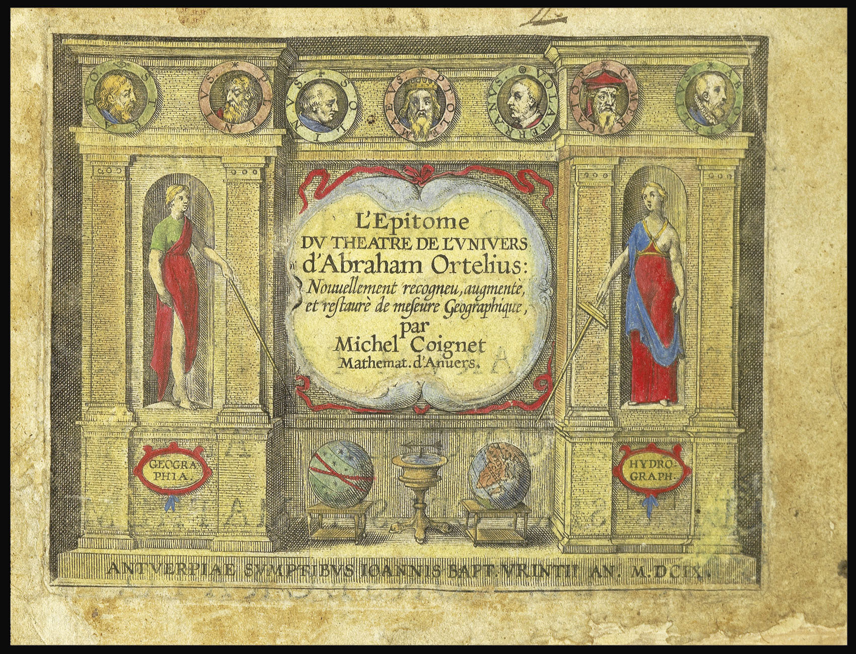

L'Epitome du Theatre de l'Univers d’Abraham Ortelius.
- Author: ORTELIUS, Abraham
- Publication place: Antwerp
- Publisher: Jan Baptist Vrients
- Publication date: 1609.
- Physical description: Oblong 8vo (115 by 170mm). 11 leaves, pages numbered 1-134, 6 pages Index, Approbatio, Privilege, verso blank. Engraved title-page, 137 engraved maps, one full-page view and 2 diagrams in the text, all with fine contemporary had-colour in full (minor marginal repairs to title-page and A3). Contemporary vellum over paste-board, title in manuscript at the head of the spine.
Collation: A-I(8), K-S(8), T(4) - Inventory reference: 12816
Notes
A fine example of Ortelius’s miniature atlas.
The “pocket edition” of Ortelius’ ‘Theatrum Orbis Terrarum’ was the first response to the demand for cheaper atlases.” (van der Krogt)
The idea of a miniature atlas was the brainchild of the engraver of Filips Galle (1537-1612). He published his first atlas in 1577, some seven years after Ortelius’ work first appeared. The work consisted of 73 maps, and had an accompanying rhyming vernacular text. The work proved hugely popular and a following twelve editions in Dutch, French, English, and Latin, were published by Galle between 1578 and 1601.
Galle’s domination of the miniature atlas market was challenged by the Antwerp bookseller Jan van Keerbergen (1586-?1624) who in 1601, published the first edition of the present work. Keerbergen commissioned Michael Coignet (1549-1623) to write a new text. All the maps in the atlas are new, and were based upon the maps in Galle’s Epitome of 1601. The maps, engraved by Ambrosius and Ferdinand Arenius, are better executed than Galle’s, and feature both latitude and longitude lines to their borders. The work also incorporates a finely engraved title-page of an architectural facade with personifications of ‘Geographia’ and ‘Hydrographia’ to the left and right, a pair of globes, and a compass below, with seven cameos of notable cartographers above, named from left to right: Strabo, Plinius, Solinus, Ptolemaeus, Volaterranus, G. Mercator, and Ab. Ortelius.
In 1604, Keerbergen sold the atlas to Jan Baptist Vrients, who had acquired the rights to Galle’s atlas in 1601. Vrients published one further edition of the atlas, the present work, in 1609.
Bibliography
- Van der Krogt 333:02B.
Image gallery
Related items


Sign up to hear about our latest acquisitions, exhibitions and events
Find Us
New York
PO Box 329, Larchmont, NY, USA
Opening hours, London Gallery
Monday to Friday: 10:00 – 18:00
Saturday: by appointment
Closed: all bank holidays and 1-31 August
Opening hours, New York
By appointment only